


According to Federal Emergency Management Agency statistics from 1994-2013, Southern California counties have large wildfires more frequently than most other counties in the state.

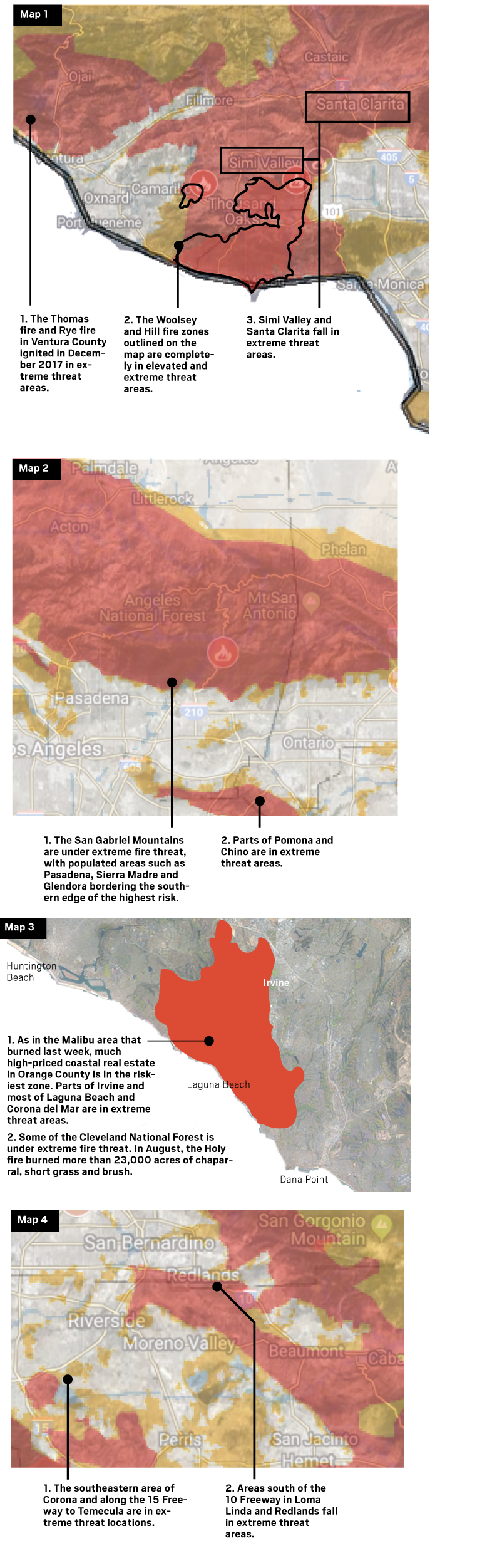
The Hill and Woolsey fires that ignited last week and burned in Ventura and Los Angeles counties were both in Tier 3 areas, where fire danger is extreme. Heres a look at zones with the same threat level.


Above is the most recent fire threat map from the California Public Utilities Commission, released in January. The CPUC created the maps that account for terrain and fuel for wildfires. In September the agency proposed another map that includes areas where wind and fire can be extreme.
Extreme threat areas[hhmc]
The fire threat map is overlaid on a satellite image of Southern California.
Heavily forested areas often fall in the extreme threat portions of the map, but dense brush such as that in Malibu, Ventura and south Orange County is a source of fuel for major fires as well.
Sources: California Public Utilities Commission, Satellite images are from Google Earth, Cleveland National Forest, InciWeb, ArcGIS, U.S. Forest Service, Cal Fire, FEMA
[contf] [contfnew] 
daily news
[contfnewc] [contfnewc]


